|
MEMORIAL TO JAMES BUCKLAND MAWDSLEY.
(1894-1964) - by A. R. Byers Dr. James Buckland Mawdsley died very suddenly on December 3, 1964, while attending a Canadian Regional Conference on Permafrost in Edmonton, Alberta. Doctor Mawdsley was born on July 22, 1894, near Siena, Italy, the son of British-American parents. When he was 10, his family decided to move and settled at Gainsborough in southeastern Saskatchewan. After receiving his public and high school training in Saskatchewan he entered McGill University in 1913. His career, like that of many of his contemporaries, was interrupted by the First World War. Twice wounded in France, first with the Princess Patricia Canadian Light Infantry and then as a pilot with the Royal Flying Corps, he was awarded the M.B.E. at the close of the war. In 1919 he returned to McGill, and 2 years later he graduated in Mining Engineering (Geology Option). His summers as an undergraduate were spent working in mines at Butte, Montana; Sudbury, Ontario; and Leadville, Colorado. He continued his geological studies at Princeton University and obtained his Doctor of Philosophy degree in Geology in 1924. While at Princeton, he worked for the Geological Survey of Canada during the summers and carried out the fieldwork for his thesis, "St. Urbain area, Charlevoix District, Quebec," later published as Memoir 152 by the Geological Survey of Canada. On graduation from Princeton, he became a member of the permanent staff of the Geological Survey of Canada, and for the next 5 years, he carried out extensive fieldwork in the Noranda-Malartic and Chibougamau areas of northwestern Quebec. A new chapter in his life began in 1929, when he accepted the appointment of Professor and Head of the Department of Geology at the University of Saskatchewan. Although at first somewhat inexperienced as a teacher, he had definite ideas about what a geologist should know and the natural ability to attract and get the best out of students. He instilled a feeling of scientific curiosity in his students and inspired them to search for truth. In 1961 he became Dean of Engineering and also the Director of the Institute for Northern Studies. He retired as Dean in 1963 and was then able to devote all his time and energy to the affairs of the Institute. In addition to his academic duties his professional activities included fieldwork in northern Saskatchewan for the Geological Survey of Canada and the Saskatchewan Department of Mineral Resources, and private consulting assignments took him to other parts of northern Canada, to the United States and Great Britain. For several years he worked on a report dealing with the Precambrian mineral deposits of Quebec, which was later published in 1949 as part of Geological Report Number 20, volume 111, "Geology of Quebec-Economic Geology," by the Quebec Department of Mines. At the time of his death, he was engaged in writing a text on mineral deposits. His published works constitute a considerable contribution to geological science, comprising 3 memoirs and 9 preliminary reports published by the Geological Survey of Canada, 10 geological reports issued by the Saskatchewan Department of Mineral Resources, and 27 papers published in scientific journals. He was a member of several professional and scientific societies. In 1933, he was elected a Fellow of the Royal Society of Canada and was Chairman of Section IV for the years 1954-1955. He was President of the Geological Association of Canada during 1955-1956 and of the Canadian Institute of Mining and Metallurgy from 1961-1962. In 1953 he was awarded the Institute's Barlow Memorial Medal in recognition of his paper "Uraninite-bearing deposits, Charlebois Lake area, northeastern Saskatchewan." He was a Fellow and Director of the Royal Canadian Geographical Society, a Fellow of The Geological Society of America, a member of the Society of Economic Geologists, the Engineering Institute of Canada, and the Association of Professional Engineers of Saskatchewan, and a Charter Associate of the Arctic Institute of North America. He had an eventful life, loved the outdoors, travelled widely, and met and was a friend to many people. Affectionally called "Jim" by those who knew him well and "Doc" by his students, he was equally at home among prospectors and miners, business leaders, scientists, and students. Such qualities as tact, kindliness, sincerity, and respect for the thoughts of others enabled him to present his views without arousing undue antagonism and to cooperate with others in reaching decisions. He had considerable artistic ability, and his hobbies included photography, sketching, and painting. His lectures in stratigraphy and ore deposits were superbly illustrated by coloured pictures which he had taken in the field, and his many friends will long cherish the sketches which appeared on his Christmas cards each year. His sudden passing brought sadness to his former students, his friends, and his geological colleagues. He was the sort of man who, if he had lived another score of years, would have found a field to absorb his energies, and a place to make continuing contributions to geology and art. 
Dr. J. B. Mawdsley in the field mapping an uraninite showing at Lee (later Jahala) Lake, 4 miles east of the east shore of Hunter Bay, Lac la Ronge - July, 1950. Assistant Jim Kermeen is using a Geiger counter for detection of radioactive minerals. Credit: Saskatchewan Archives Board, Photograph no. RA 18650(4).
APPENDIX B.
NICKEL EXPLORATION, LAKE ATHABASCA - 1914-1916.
by D. Neufeld
The first mention of the possibilities for the discovery of base and precious metals in northwestern Saskatchewan appeared in the Annual Report of the Geological Survey of Canada for the year 1895 (Tyrrell and Dowling, 1896). This report records the findings of two reconnaissance trips through northern Saskatchewan, the first in 1892 and the second in 1893. In June 1892, Joseph Burr Tyrrell (1858-1957), an officer of the Geological Survey of Canada from 1881, set out from Prince Albert overland down the Beaver River valley to Ile-a-la-Crosse. From there, with hired Indian help, he ascended the Mudjatik River to Cree Lake, descended the Cree River to Black Lake, and went west on the lake to the Hudson's Bay Company post at Fond du Lac. There he met his assistant, Donaldson Bogart Dowling, who had come from Edmonton down the Athabasca River to follow and survey the south shore of Lake Athabasca. Together Tyrrell and Dowling travelled to Wollaston Lake where they split up. Dowling went south on Reindeer Lake. On the shore of this lake, he discovered and later described a sulphide showing containing "a small percentage of nickel and traces of cobalt", the first description of any such mineralization in the Precambrian rocks of northern Saskatchewan. Dowling went down the Reindeer River to the Churchill River which he ascended to Stanley Mission to travel from there via Lac la Ronge to Prince Albert. Tyrrell ascended the Geikie River to the Foster Lakes, came down the Foster River to Churchill, and via Ile-a-la-Crosse travelled overland back to Prince Albert where he arrived on 2 October, ten days before Dowling. Thus the first geological map showing some differentiation of rock types along traverses or tracks through northern Saskatchewan was produced. In the summer of 1893 J. B. Tyrrell, this time assisted by his brother, James W. Tyrrell, again travelled in northern Saskatchewan. The northern shore of Lake Athabasca was then mapped. In the report (Tyrrell and Dowling, 1896), mention is made of red hills of hematitic quartzite near the northeastern shore of Lake Athabasca. More importantly, the presence of large amounts of norite, an igneous rock similar to gabbro and associated with the nickel deposits at Sudbury, was reported from Pine Channel. In 1910 a prospector named Piche staked a claim for copper and nickel on the north shore of Lake Athabasca, west of Robillard Bay, 18 miles east of Fond du Lac. In 1912 the claim-staking by Piche and other prospectors continued but moved farther east along the north shore of Lake Athabasca to the Narrows, at the eastern end of the lake, 30 miles east of Fond du Lac. Three Piché prospectors, Thomas, Jean, and Jenner (possibly his brothers or cousins, in whose names Piché registered his finds, as was common practice at the time) staked claims there in June 1912. Also in 1912, an expedition backed by the then Lieutenant-Governor of Alberta, G. H. V. Bulyea, and led by E. N. Burwash, son of the Chancellor of Victoria College, University of Toronto, prospected in the eastern Lake Athabasca area. The results of all this prospecting for iron, copper, and precious metals were disappointing. This small beginning caused no great excitement and many of the claims either were never registered or allowed to lapse the following year. The prospectors failed to find the gold-bearing quartz veins that would be discovered in the same area in 1935. Probably during the summer of 1913 or early in the field season of 1914, Harold Victor Dardier reconnoitred the area mentioned by Tyrrell as having a potential for the occurrence of nickel. Harold was the son of Stephen V. Dardier, one of the directors of foreign marketing for the British armament firm of Vickers Ltd. Insecurities of supply from existing producers made a new private supply of nickel attractive to Vickers who, therefore, had backed nickel exploration for several years. So they now backed young Dardier. The search for nickel encouraged the existing producers to offer Vickers long-term, low-cost contracts for the supply of the metal to reduce the chances for the creation of a competitor. Dardier likely was attracted to the Lake Athabasca area by the published reports of the Geological Survey of Canada embodying Tyrrell's work and the staking rush of 1910-1912 started by Piché. Also in 1914, F. J. Alcock of the Geological Survey of Canada reported finding traces of nickel in the areas mentioned by Tyrrell. Dardier's work concentrated in an area about 12 miles east of Fond du Lac where two claims, the "Paris Group", were registered in Edmonton on 9 July 1914. The presence of sulphides, some associated with norite and containing nickel and copper, was the main attraction. In his venture, Dardier was joined by a prospector named Dalton, who had also staked claims in the area. In the summer of 1914 Dardier, accompanied by two other prospectors, John Gibbs Devlin and George Fowler, travelled down the Athabasca River and across Lake Athabasca. Their starting point was Athabasca Landing, Alberta, then the end of steel. Their destination was the Fond du Lac area where Dardier had prospected before. After having spent five months in the field, Dardier, Devlin, and Fowler returned to Athabasca Landing in mid-January, 1915. During the 1914 field season, they had prospected in the Pine Channel area of Lake Athabasca. They had studied the shoreline of the lake carefully and along Sucker Creek and Norite Bay, they had staked 20 claims following two outcrops inland for some distance and out into the islands in the lake to ensure complete coverage of the outcrops. They carried out a few hundred pounds of ore samples and subsequent work on their claims were some of the earliest explorations to be done in northern Saskatchewan. While Dardier went to England with some rock and mineral samples, John Devlin, a Scot who had prospected previously in British Columbia for "old country" interests, stayed in Athabasca Landing. In the first week of March, well after Dardier departed for England, Devlin released the results of an assay on a few small samples of ore that he claimed to have picked up in the Fond du Lac area. The Athabasca Northern News immediately proclaimed in bold headlines that "AN ELDORADO OF SILVER" had been found at Fond du Lac. Devlin's ore had assayed silver at $11,000 per ton, or almost pure silver. He claimed that he would lead an expedition back to the claim when navigation opened. Colin Fraser, an old trader, told the Edmonton Journal that there was a silver ledge 3 feet deep and 3 miles long. Within two weeks the newspapers had expanded the find to proportions that dwarfed the mammoth silver lode of Cobalt, Ontario. Mining men from across North America were attracted to the district and eagerly awaited the opening of navigation in Athabasca. The journalists had a field day but it appears that very few Athabasca locals were swept up by the "silver rush" that developed that spring. The stores were quick to point out that they could outfit any prospector going north for a fair price. The Athabasca Board of Trade refused to make a statement on the silver find but published a pamphlet explaining the advantages of bringing money to their town. Even the Hudson's Bay Company in Edmonton got involved by printing a pamphlet describing the various routes into the Fond du Lac region and, no doubt, pointing out the location of Hudson's Bay Company posts along the way. More enterprising citizens offered a variety of other services. One river pilot spoke highly of the rich silver find but allowed, as he wasn't much for mining, that he would be happy to guide people across the Athabasca rapids and sell them transport scows. Two others went north to establish a restaurant in the area and one intrepid local, perhaps reflecting the view of the town, "invented a simple flying machine. . . [with] a silk car in the rear for carrying silver. . . to ply between here [Athabasca Landing] and Fond du Lac." A few went north but it appears that the locals were careful about the silver find. Nevertheless, the excitement drew people from all over the continent and in the spring of 1915 it was estimated that as many as 150 prospectors were studying the area for silver. Charles Camsell of the Geological Survey of Canada was also ordered to study the area and report on the silver claims. Camsell had some difficulty locating the area as Dardier was still in England and Devlin had dropped from sight shortly before he was to lead his large expedition into the area. Camsell spent several weeks investigating the silver story and studied many of the claims in the area. He felt that Devlin's story was based upon ore that came from somewhere else, possibly Cobalt. He concluded, however, that the area had possibilities for nickel, copper, silver, and gold. Throughout the summer, the excitement died down and by July only about 25 prospectors were still in the area. After seeing Dardier's samples and receiving his report in the spring of 1915, Vickers decided to pursue further work in the areas. Dardier returned to Edmonton later that summer and began organizing a major expedition to develop his nickel claims east of Fond du Lac. In September 1915, Harold Dardier prepared to leave for the North. His party consisted of 25 engineers, assayers, and mineralogists, about 75 Metis labourers, and two White women: his wife and the wife of Mr. Miller, the camp foreman. For the trip down the Athabasca River and to the site, 18 scows were used to carry the people, some 70 tons of supplies (including mining equipment), and sufficient food and clothing to support the crew for one year. 
Dardier brought about 75 tons of freight, spending $50,000 on drilling equipment, derricks and other mining requirements, and some $10,000 worth of other supplies in Edmonton. In addition to these supplies, Dardier took 5,000 crisp, new $1 bills to pay Indians for portage and other work. Altogether it was estimated that the expedition cost about $100,000. The Edmonton Bulletin declared that it was, "the best outfit sent north in the past seven years". 
The mining equipment consisted of two Davis calyx steam-powered shot drills for obtaining core samples. These drills, manufactured by the Ingersoll-Rand Drill Company of New York, were of the rotating, hollow-core type with a cutting surface consisting of steel shot distributed along the bottom edge of the rotating bit. By 1920 this type of drill was largely replaced by the more efficient diamond drill. Once in Fort Chipewyan, it was possible to make arrangements to have a steamboat tow scows to Fond du Lac. During the springtime silver rush of 1915 the Hudson's Bay Company steamer, Keewatin, had transported scows and prospectors to the eastern end of the lake. No doubt the steamer was still in the area in the fall for Dardier's use. Dardier and his party arrived on the site where they erected a comfortable camp in the late fall of 1915. By early 1916 drilling was underway. It continued all during the winter, spring, and summer of 1916, but nothing of economic interest was found. When navigation opened in the spring of 1916, Dardier and his wife left for Edmonton. He was going to meet with people from Vickers to report on his exploration work and he told his crew that he would return in late June with additional supplies. He did not return as promised, but his crew continued work until late August when their supplies eventually ran out. The camp was abandoned on August 25th, when the remaining members of the drill crew took a scow to Fond du Lac, 20 miles to the west. Here they met the Hudson's Bay Company Keewatin and, on the following day, were towed towards Fort Chipewyan and the outside. The summer of 1914, was spent mapping the geology of a band of the country of varying width lying along the north shore of Lake Athabasca. The object of the work was to study the geological problems of the country, and more particularly to examine the mineral resources of the region and to report on the mineral claims which have been staked there. The journey to the field was made with Charles Camsell and A. G. Haultain, of the Geological Survey, Fort Chipewyan at the west end of the lake being reached on June 3. Work was begun at the east end of the area where the Carp River empties into the Stone or Black River. The work was of a reconnaissance nature, and mapping was done by ascending streams by canoe and by land traverses varying in number and length according to the importance of the country and its accessibility. The mineral claims were examined, and at several places traverses were made on the south shore to study the Athabasca sandstone and to determine if possible whether the sandstones found on the north shore could be correlated with it. Actual fieldwork in the area was completed on September 16. The journey from the field was made with Mr. Camsell's party and Edmonton was reached on October 12. The writer wishes to make special acknowledgment to Mr. Percy Abbott, of Edmonton, who was most courteous in showing specimens of ore from his mining claims on the north shore of the lake and who also very kindly furnished a copy of the assays which he had made. Assistance in the field was rendered most efficiently by W. S. McCann. * * * * * * * *
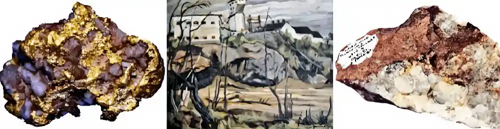
Economic minerals found were graphite, hematite, and pyrrhotite. The graphite occurs disseminated in certain of the gneisses but not in sufficient quantities to be commercially important. It was found at various places from the Beaver River east of the Narrows. The hematite is found in the Tazin series in the area around Beaverlodge Bay and some years ago several mining claims were staked on it. The hematite consists of bedding deposits associated with the quartzite, but there has been a great amount of secondary deposition with the formation of veins of hematite in fractures and joints in the quartzite. An analysis of the hematite showed 66.7 percent iron, but the amounts seen were entirely too small to be of economic importance. Several claims have been staked for nickel on iron-stained outcrops which have the nature of fahlbands22 in the gneiss. In a number of these, pyrite and pyrrhotite were found but in very limited amounts. In places in the norite at the east end of the lake, pyrite and pyrrhotite are found disseminated, and along certain fracture zones there has been concentration enough to produce a prominent iron cap, but in no case was sufficient ore seen to warrant development work. Of several assays of pyrrhotite ore, only one showed nickel in workable amounts. Many of the claims staked were never recorded and of those that were, only six are now held, and on these, no development work has been done. Further prospecting, however, may lead to the discovery of something more promising than has yet been found. (Excerpts from Alcock, 1915, p. 60-61.). On receipt of instructions to make an examination of the region about the east end of Lake Athabaska, where discoveries of high-grade silver ore were reported to have been made recently, I left Ottawa on May 29, [1915] and proceeded by rail to Athabaska [Landing, Alberta] and thence by canoe by way of Athabaska river and lake to the trading post of Fond du Lac, the nearest point to the locality to be examined. Fond du Lac was reached on June 27 and after a stay of two weeks during which all the localities where mineral claims had been staked were examined, the return journey was commenced on July 10. We returned by way of Peace River, but in consequence of delays due to stormy weather and the wreck of the Hudson's Bay Company's steamer, McMurray, Edmonton was not reached until August 26. The whole distance covered by rail, canoe, and steamboat from the time of leaving Edmonton until our return was approximately 2,000 miles, and the time consumed a little more than two and a half months. The district examined and that in which the mineral claims were taken up is situated on the north shore of Athabaska Lake about 20 miles east of the trading post of Fond du Lac, and extends along the shore of the lake from the mouth of Robillard River past Sucker bay and Pine Channel narrows to Camille bay. An isolated group of claims, the Paris group, lies a few miles west of Robillard River near the mouth of Grease River. The distance to the centre of this district from Athabaska, the nearest railway point, is about 650 miles by way of Athabaska River and Athabaska Lake, and as no regular passenger or freight boats are plying the whole way between these two points the traveller must find his means of transport unless he can connect with the casual trips of the fur traders who operate their steamers mainly for their convenience. My trip into the locality was made entirely by canoe, with two canoemen, but we were saved a great deal of time and hard work through the courtesy of Mr. Colin Fraser of Chipewyan who very kindly lent us a small canoe motor for the 200-mile trip down Athabaska lake. * * * * * * * *
Mineral claims were first taken up in this district in 1912 by some prospectors sent out by Lt.-Gov. G. H. V. Bulyea, and his associates, and a small amount of work was done. Other prospectors were in the same district in 1913 and 1914, but iwas not until the early part of 1915 that a wider interest was aroused by the reported discovery of high-grade silver ore, and in March prospectors began to rush in to stake claims. The influx of prospectors continued throughout the spring and early part of the summer until altogether about 150 men reached the district, nearly all of them travelling by way of the Athabasca River. By the beginning of July interest in the district began to wane because no discoveries of high-grade silver ore were being made, and at the time my party left there were not more than twenty-five prospectors remaining in it. * * * * * * * *
The reason for a further investigation this summer was the publication in many Canadian newspapers of an assay of silver ore said to have been obtained from the norite belt which yielded about $11,000 in silver to the ton. This sample of silver ore was reported to have been obtained by certain prospectors who spent the autumn of 1914 in the district and early in 1915 went out by dog teams to Edmonton. Believing that the occurrence of this silver was similar to that of the high-grade silver ores in Cobalt, Ontario, prospectors rushed into the district with the idea of taking up mineral claims in the locality where this sample was supposed to have come from. A number went in with dog teams in March and April, and several more started from Athabaska by boat as soon as Athabaska River was free of ice. Most of these men had powers of attorney to stake claims for their friends and as a result, hundreds of claims were taken up and filed in the Dominion Lands Office at Edmonton or Fort Smith. Most of those who took up claims were not prospectors by occupation and a few of those who were familiar with the conditions under which silver occurs at Cobalt were not sufficiently impressed with the region and returned without staking anything. My efforts were directed to finding the locality from which the high-grade silver ore was reported to have been obtained and to a general reconnaissance of a belt of country extending along the north shore of Athabaska Lake from the mouth of Grease River to Camille or Fishing Bay, a distance of about 20 miles, along which the mineral claims had been staked. The first was rather difficult because the original owner of the sample was not present in the district, and because different localities were given to me by different individuals who were supposed to know. * * * * * * * *
As a result of my investigations of the geology of the belt extending from Grease River to Camille Bay on the north shore of the lake, the following conclusions have been arrived at respecting that belt: No evidence could be obtained that silver ore assaying $11,000 to the ton occurs anywhere in the region examined, and in my opinion, the sample that gave that assay result must have come from elsewhere and possibly from outside the district altogether. The country rock of the district examined is mainly norite and more like the Sudbury field than that of Cobalt, and consequently shows much more evidence of being a copper and nickel-bearing rock than silver. There is undoubted evidence of nickel and copper occurring in the norite, but from the showings on the surface, the ore bodies appear to be too small and of too low grade to be economically important at present in a region so remote from railway transportation. Little real prospecting has been done and very little development work; and, as far as we were able to determine, no high-grade silver ore-bodies, or even bodies of copper and nickel ore such as could be worked at a profit in that region, have as yet been proven. There is, however, sufficient evidence of sulphide mineralization throughout the region embracing the north shore of Athabaska Lake to justify a hope that deposits of nickel, copper, silver, or gold ores may yet be found that would be sufficiently valuable to work. From a mining point of view, the district is as yet unproven and there was no warrant for any excitement or stampede of prospectors into it. Owing to the remoteness of the region, only high-grade ore deposits can be worked at present and prospectors should apply themselves to the search preferably for free milling gold quartz, or high-grade silver deposits such as those at Cobalt. There is a vast area of virgin territory on the north side of Athabaska Lake, unprospected and even unexplored, and in some of the belts of older sedimentary rocks lying in the granite or gneiss are many strong and well-defined quartz veins. Gold in small amounts has already been found in some of these quartz veins and all of the areas are worthwhile prospecting for that metal. The chances for high-grade silver deposits are not as clear as for gold, but sills of diabase do occur in the neighbourhood of the norite belt and these should always be carefully examined for calcite veins bearing native silver and the minerals usually associated with it. So much time is consumed in getting to and from the district about Athabaska Lake that intending prospectors should make up their minds about winter in the country and the kind of man required for that work is one who can combine trapping furs during the winter with prospecting for minerals in the summer months. (Excerpts from Camsell, 1916, p. 120-126). Dardier did return to the area later in the fall of 1916 with some gas-engine-operated diamond drills and a small crew. Despite some difficulties with the temperamental gas engines of the day, he spent about ten months in the area doing some additional drilling about 12 miles east and 12 miles west of the original camp. No worthwhile orebodies were discovered in these areas. In the late summer of 1917, he left and in September the Engineering and Mining Journal reported his claim that: "Nickel deposits of considerable extent . . . have been found." Despite his claims, however, Dardier did not conduct any further development work. Over the next 65 years, the camp was scavenged by visitors for tools, supplies, lumber, and souvenirs. Early in the 1960s, Dr. Ralph Cheesman, then Chief Geologist of the Saskatchewan Department of Mineral Resources and now Manager of the Saskatchewan Mining Association, discovered the abandoned shot drills on Dardier Island. In the summer of 1981, the Saskatchewan Mining Development Corporation (SMDC) took steps to preserve this evidence of early Saskatchewan mining history. 

Co-operation between the SMDC and the Western Development Museum led to the mounting of an expedition to survey the site and to remove the drills to Saskatoon. Tim Jones, an archaeologist, spent a week on the site with Len Wawryk, SMDC Public Relations Officer, carefully recording site data and preparing the drills and related equipment for shipment. Jones focused his attention on the mining equipment and recovered the two shot drills, a variety of drill stems, bits, and other items, as well as the two large vertical boilers. In all, some 185 pieces were collected, labelled, and prepared for shipment. Preliminary identification of parts was done on site but more thorough work will be undertaken in Saskatoon. Ingersoll-Rand has kindly supplied the museum with a valuable set of drawings to assist in this task. Notes on other remains on the island were made as well. References: Alcock, 1915 and 1917; Camsell, 1916; Mawdsley, 1940; Neufeld, 1982a, 1982b, 1982c; SMDC 1981a and 1981b; Tyrrell and Dowling, 1896; Wawryk, 1981. |
Questions - Comments?


Links to all jkcc.com Webpages:
| Ausland Lake |
Northern Saskatchewan
| Deep River Fur Farm |
| Deep River Trapping Page |
| Deep River Fishing Page |
| My Norwegian Roots |
| Aasland Farm, Norway |
| My Norwegian Family |
| Early Mink of People Canada |
E. Rendle Bowness
| The Manager's Tale |
Hugh McKay Ross
| Sakitawak Bi-Centennial |
200 Year History.
| Lost Land of the Caribou |
Ed Theriau
| A History of Buffalo Narrows |
| Hugh (Lefty) McLeod |
Bush Pilot
| George Greening |
Bush Pilot
| Timber Trails |
A History of Big River
| Joe Anstett, Trapper |
| Bill Windrum, Bush Pilot |
| Face the North Wind |
By Art Karas
| North to Cree Lake |
By Art Karas
| Look at the Past |
A History Dore Lake
| George Abbott |
A Family History
| These Are The Prairies |
| William A. A. Jay, Trapper |
| John Hedlund, Trapper |
| Deep River Photo Gallery |
| Cyril Mahoney, Trapper |
| Saskatchewan |
A Pictorial History
| Who's Who in furs |
1952 to 1956
| A Century in the Making |
A Big River History
| Wings Beyond Road's End |
| The Northern Trapper, 1923 |
| My Various Links Page |
| Ron Clancy, Author |
| Roman Catholic Church |
A History from 1849
| Frontier Characters - Ron Clancy |
| Northern Trader - Ron Clancy |
| Various Deep River Videos |
| How the Indians Used the Birch |
| The Great Fur Land |
| The Death of Albert Johnson |
| A Mink and Fish Story |
Buffalo Narrows
| Gold and Other Stories |
Berry Richards
| Saskatchewan James Carnegie |